
How Does GPS Tracking Work? – Complete Guide
How Does GPS Tracking Work? — Complete Guide 2026
By MototechGPS Team · Updated April 2026 · 10 min read
You plug a GPS tracker into your car, open an app on your phone, and see your vehicle's exact location on a map. It feels like magic. But behind the screen, a remarkably elegant system of satellites, cellular networks, and software is working together every second to make that dot move accurately across your map. Here is exactly how it works.
The 4-Step Journey from Satellite to Your Phone
Step 1 — The GPS Satellite Constellation
GPS stands for Global Positioning System. It is owned and operated by the US government — specifically the US Space Force — and consists of at least 24 operational satellites orbiting the Earth at approximately 12,550 miles altitude. These satellites continuously broadcast radio signals containing their exact position and the precise time the signal was sent.
Your GPS tracker's receiver picks up signals from at least 4 of these satellites simultaneously. By measuring the tiny time differences between when each signal was sent and when it arrived, the device calculates how far it is from each satellite. Using these distances from 4+ known positions in space, it can pinpoint its own location on Earth to within 10–30 feet through a process called trilateration.
Step 2 — How the Tracker Calculates Position
Inside your GPS tracker is a GPS receiver module — a specialized chip that continuously listens for satellite signals. The moment it receives signals from at least 4 satellites, it calculates the device's latitude, longitude, altitude, speed, and direction using trilateration mathematics. This calculation happens in microseconds and is repeated every 1–60 seconds depending on your tracker's update rate setting.
Modern GPS receivers also use Assisted GPS (A-GPS) — they connect to the cellular network briefly to download almanac data about current satellite positions, which dramatically speeds up the initial location fix from minutes down to seconds.
Step 3 — The Cellular Transmission
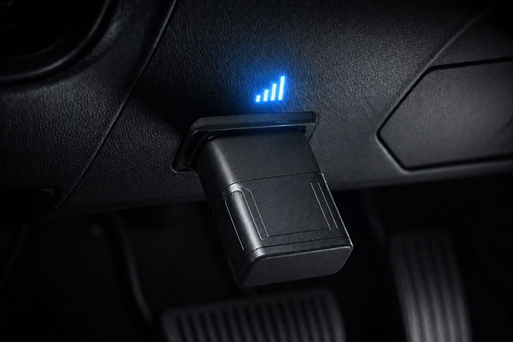
GPS tells the tracker where it is. But knowing your location and telling you your location are two very different things. This is where the cellular network comes in. Inside every real-time GPS tracker is a SIM card connected to 4G LTE networks — the same networks your smartphone uses. Once the GPS module calculates the device's coordinates, it transmits this data packet via cellular to the tracker company's servers.
This cellular transmission is why real-time GPS trackers require monthly subscriptions — they are continuously using cellular data, and that data costs money. Trackers like Bouncie include a pre-installed AT&T and T-Mobile SIM with the subscription fee covering all data costs.
Step 4 — From Server to Your Phone
The GPS coordinates transmitted by your tracker arrive at the tracker company's servers, where they are processed, stored, and pushed to your smartphone app. The app overlays your vehicle's location on a digital map — typically Google Maps — and updates the dot every time new coordinates arrive. This is what you see as the "live dot" moving across your map.
The app also processes alerts — if speed exceeds your set limit, if the vehicle crosses a geofence boundary, or if the crash detection accelerometer triggers, the server generates a push notification and sends it to your phone immediately.
Why GPS is Less Accurate in Some Places
GPS accuracy depends on how many satellites the receiver can see. In open sky conditions, modern trackers achieve 10–30 feet of accuracy. In dense urban areas surrounded by tall buildings (urban canyon effect), satellite signals bounce off buildings before reaching the device, causing slight position errors of 30–100 feet. Underground parking garages and tunnels block satellite signals entirely — the tracker loses its GPS fix and typically shows the last known position until it exits.
Modern trackers like Bouncie partially compensate for this by using cellular tower triangulation when GPS signal is weak — less accurate than satellites but better than nothing.
GPS vs Bluetooth vs WiFi Tracking — What is the Difference?
GPS tracking uses satellites and cellular networks — it works anywhere with cellular coverage and is accurate to 10–30 feet. Bluetooth tracking (like Apple AirTag) only works within Bluetooth range of other devices — effective range is about 100 feet. WiFi positioning uses nearby WiFi network locations to estimate position — accurate indoors where GPS struggles but requires WiFi networks to be present. Real-time vehicle tracking always requires GPS combined with cellular, never Bluetooth or WiFi alone.
Satellites to your phone in 15 seconds. Crash detection, geofencing, vehicle diagnostics. Only $8–$9/month.
→ Get Bouncie GPS — Try It TodayFrequently Asked Questions
How does a GPS tracker work in a car?
A car GPS tracker has two key components — a GPS receiver that calculates the vehicle's position by receiving signals from orbiting satellites, and a cellular modem that transmits that position to the tracking company's servers via 4G LTE. You view the real-time location on a smartphone app connected to those servers. The entire cycle — from satellite signal to your phone screen — takes 2–15 seconds depending on the tracker's update rate.
Does GPS work without internet?
GPS satellite signals are received without any internet connection — your tracker's GPS module calculates position from satellite signals alone. However, transmitting that position to the tracking server (so you can see it in your app) requires a cellular data connection. Without cellular data, the tracker continues calculating and storing locations locally but cannot send them to your app in real time.
How accurate is GPS tracking?
In open sky conditions, modern consumer GPS trackers are accurate to within 10–30 feet. In dense urban environments, accuracy may decrease to 30–100 feet due to signal reflections. Underground or inside buildings, accuracy can degrade further or the GPS fix may be lost entirely. For practical vehicle tracking purposes, 10–30 foot accuracy is more than sufficient for identifying a vehicle's location on a street-level map.
How many satellites does GPS use?
The US GPS constellation maintains at least 24 operational satellites in medium Earth orbit at any time. As of 2026, there are 31 active GPS satellites. Your tracker's receiver needs signals from at least 4 satellites simultaneously to calculate a 3-dimensional position fix (latitude, longitude, and altitude). More satellites in view generally means higher accuracy.